MAPS
A selection of nine maps are available in the image carousel below.
Use the right and left arrows to view the maps in the image carousel.
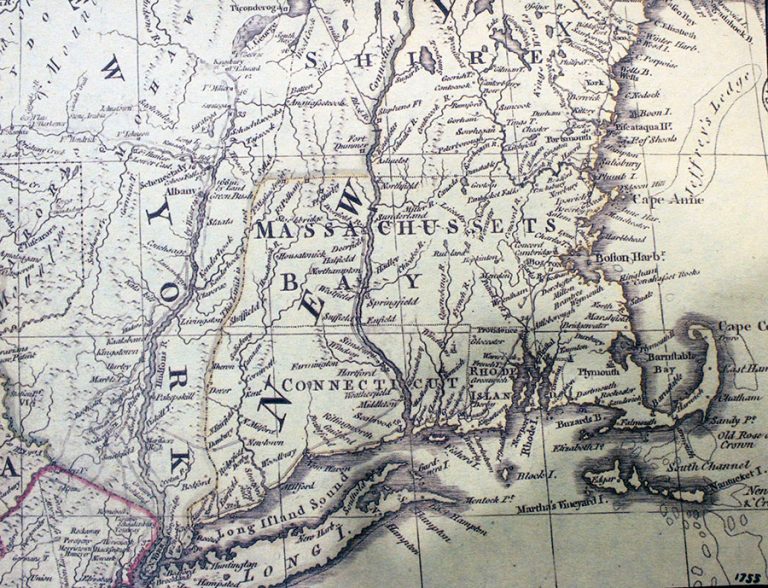
Map 1.
Section of a colonial Map of New England, 1755. Massachussetts Bay, Connecticut, Rhode Island, and New York. From the Mary Lynn Smith collection.
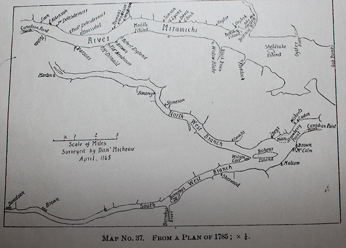
Map 2.
Map 37. From a Plan of 1785. Miramichi settlement pattern (no Lot Numbers). Surveyed by Dan’ Micheau.
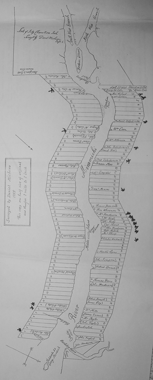
Map 3.
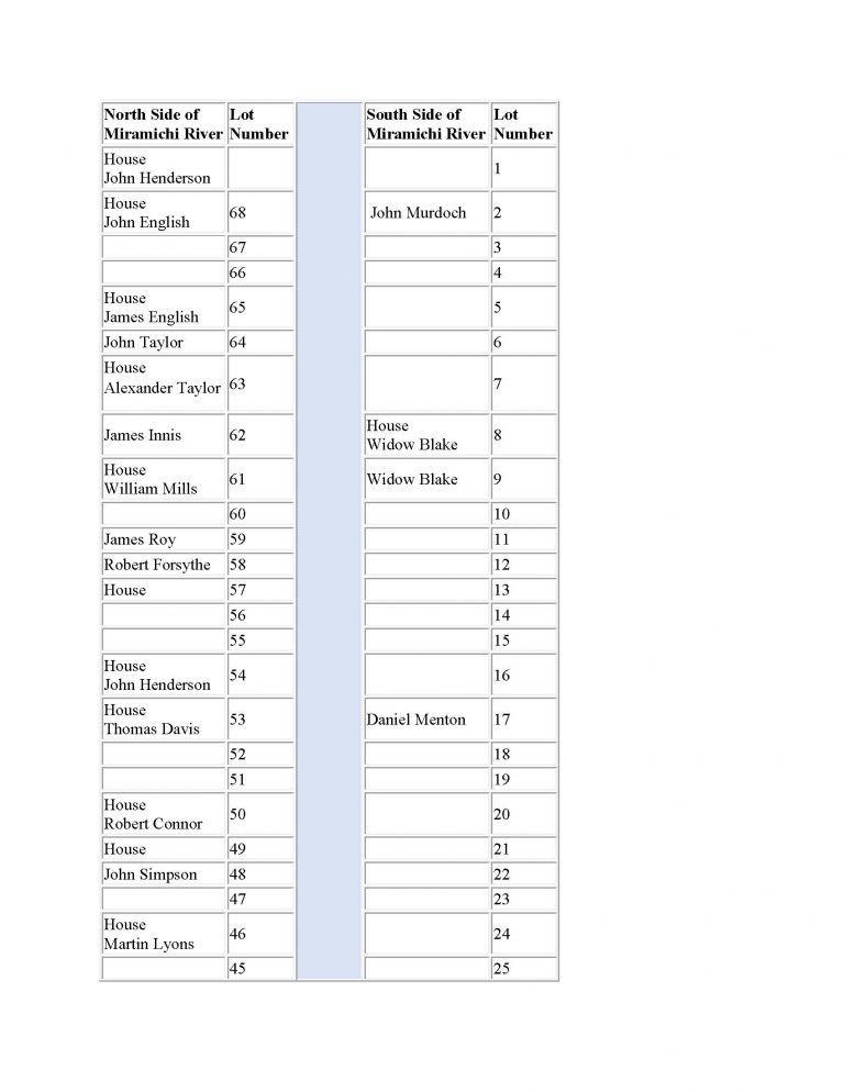
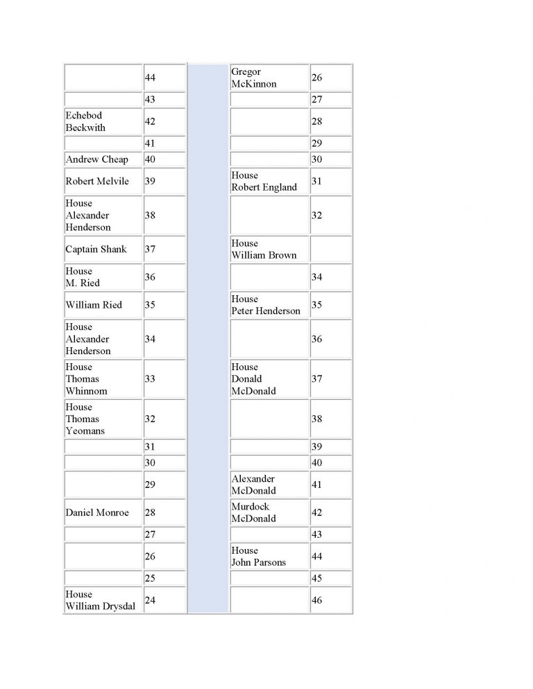
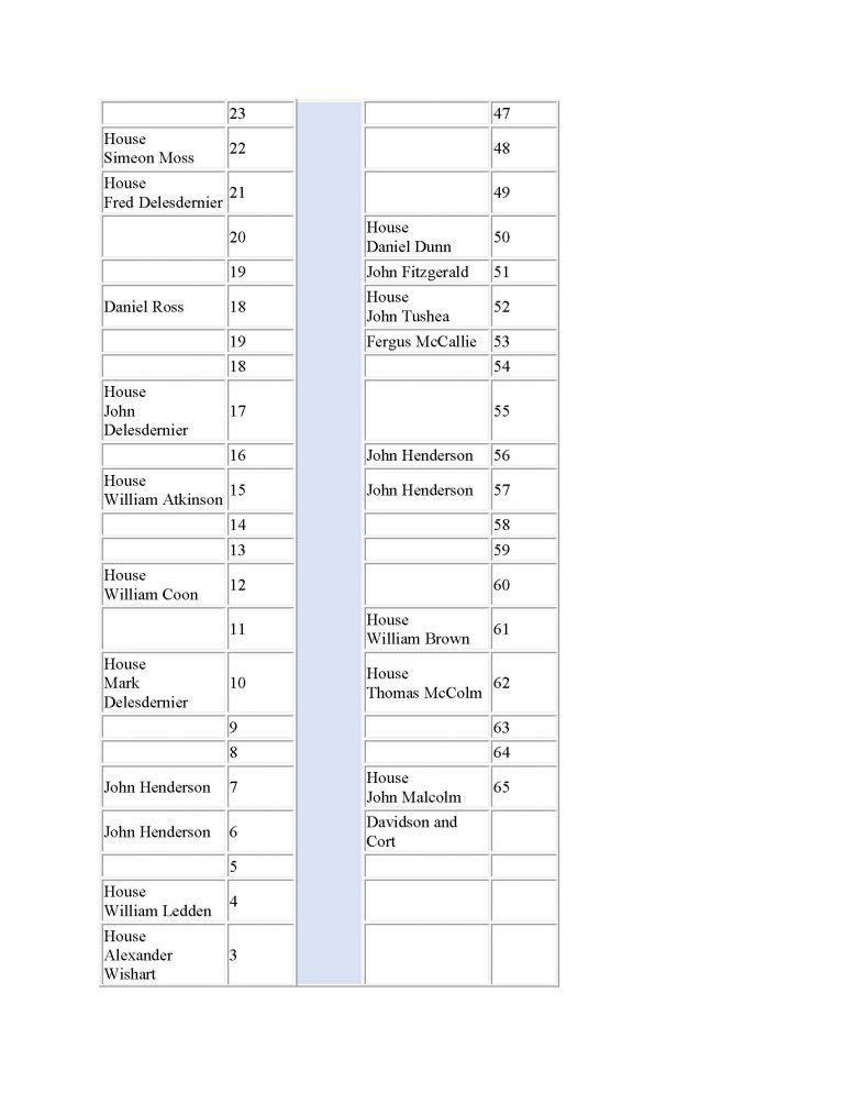
Miramichi River Lots Surveyed by Daniel Micheau 1785.
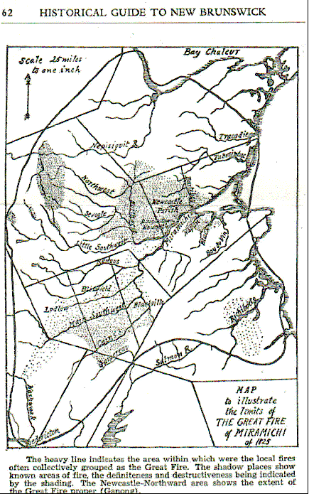
Map 4.
Map to illustrate the limits of the Great Fire of Miramichi of 1825.
Map 5.
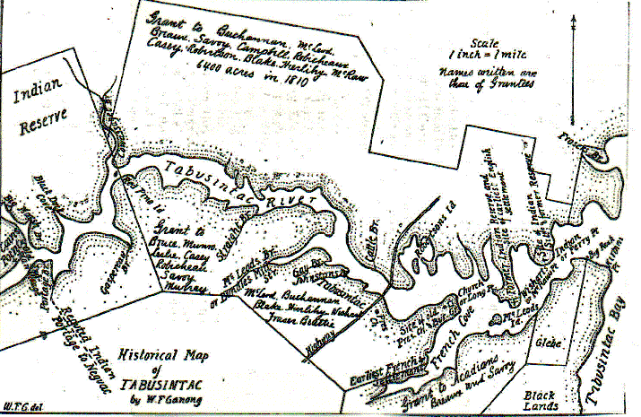
Historical Map of Tabusintac by W.F. (William Francis) Ganong.
Map 6.
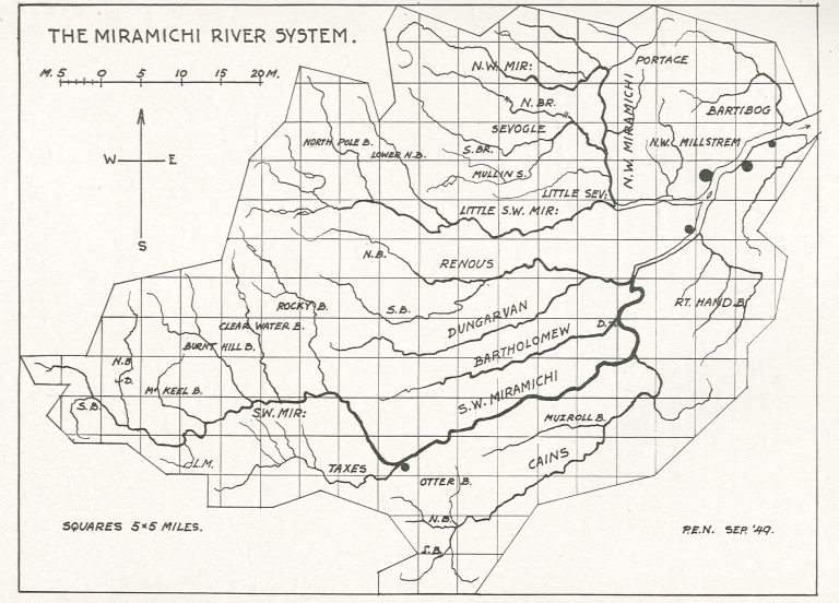
Knob’s Map of the Miramichi River System September 1949.
Map 7.
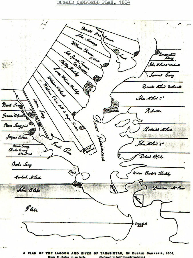
A Plan of the Lagoon and River of Tabusintac, by Dugald Campbell, 1804.
Map 8.
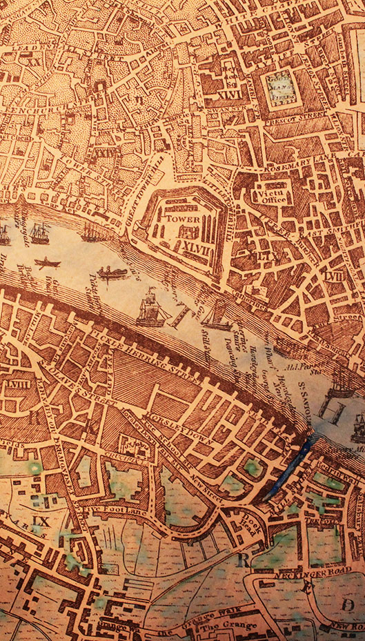
From: A NEW & ACCURATE PLAN of the CITIES of LONDON & WESTMINSTER & BOROUGH of SOUTHWARK with the NEW ROADS & new BUILDINGS to the present YEAR 1799 from a late SURVEY to which is added many usefull TABLES VIEWS, & c. LONDON
Pulbifh’d Jan y.1st. 1799. by J. EVANS No. 12 Long Lane, Weft Smithfield
From the Mary Lynn Smith collection.
Map 9.
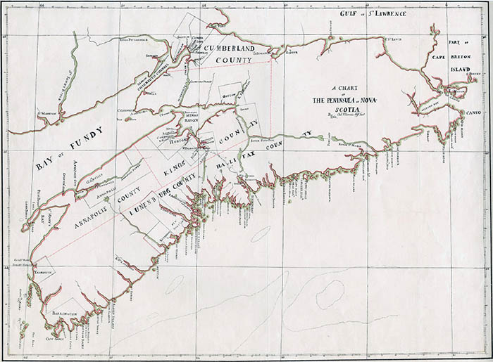
A Chart of the Peninsula of Nova Scotia from New England Plantars of Nova Scotia, Public Archives of Nova Scotia. Date 1761. Drawn by Charles Morris, Chief Surveyor. An undated copy of Charles Morris’s original chart which shows the townships of Nova Scotia. This chart shows various townships surveyed for occupation by incoming New England plantars. The Chart clearly shows the St. John’s River (to-day’s Saint John River). Two hundred plantar families from Massachusetts travelled north in 1763 and settled at Maugerville Township, on the St. John’s River.
The following Tables are a textual representation of the carousel image: Map 3. Miramichi River Lots 1785 by Daniel Micheau, Surveyor:
Image Carousel
